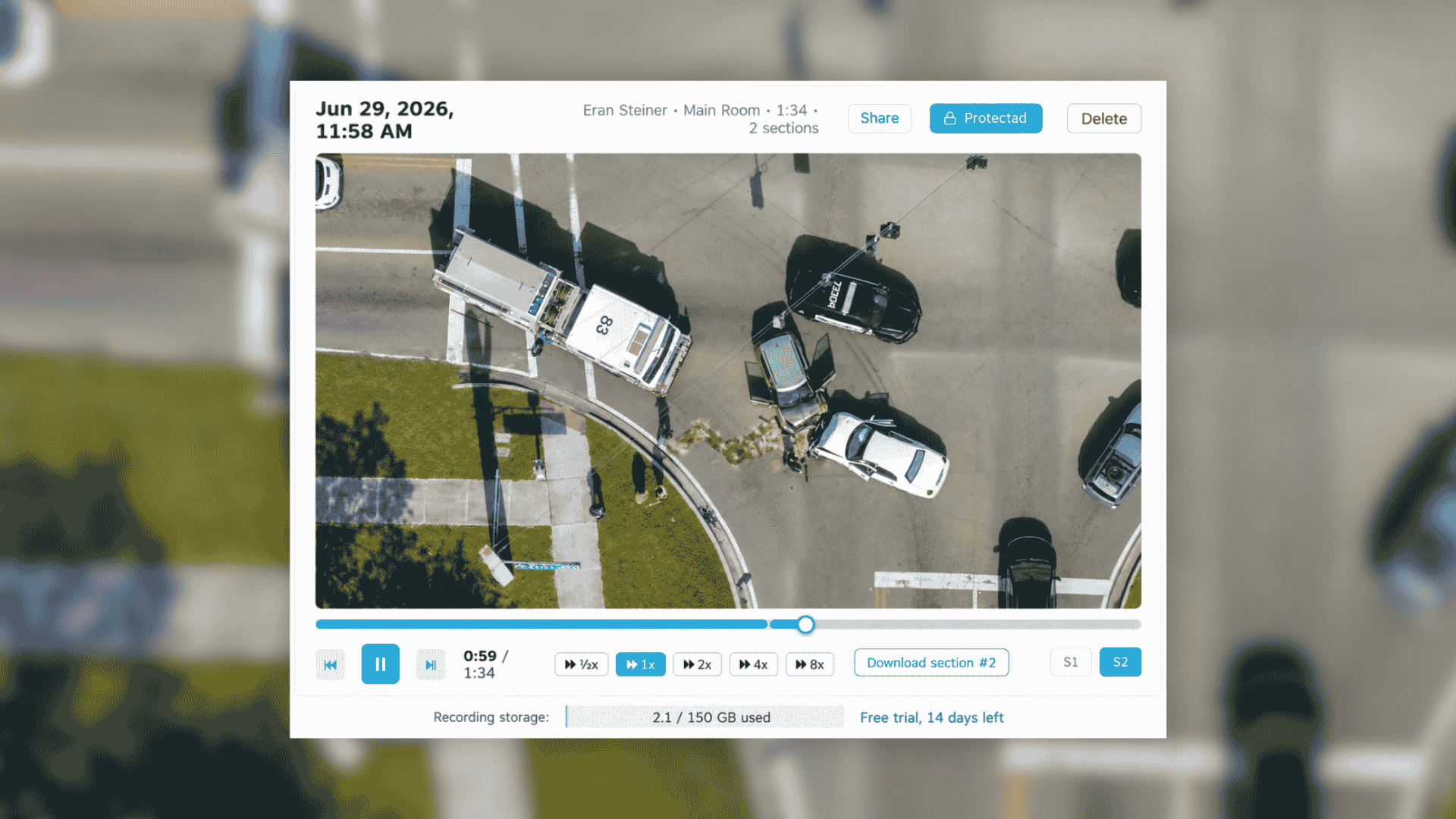
AirData launches cloud recording and 10-minute rewind for drone live streaming
AirData has launched Stream Recording and Rewind for AirData Live Streaming, giving drone programs more control over live video during an operation and after the flight.
AirData has launched Stream Recording and Rewind for AirData Live Streaming, giving drone programs more control over live video during an operation and after the flight.
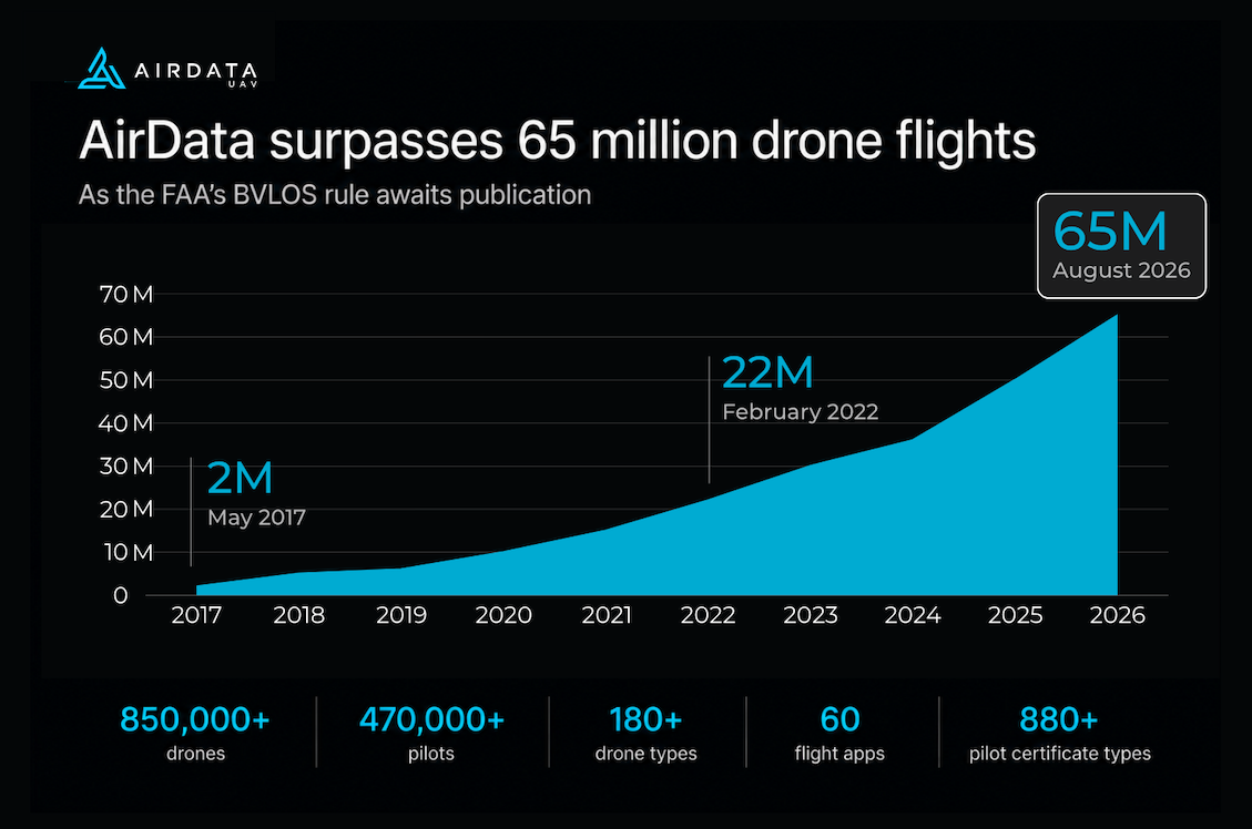
AirData has passed 65 million drone flights, covering more than 850,000 drones and 470,000 pilots worldwide. The milestone comes as the FAA's final Part 108 rule for routine beyond...

Pilots, aircraft, missions, and compliance in one system, across the complete flight.

FAA Part 108 is the most significant proposed change to drone regulation since Part 107 came out in 2016. It sets up a formal framework for Beyond Visual Line of...

AirData UAV, the drone fleet management platform behind serious drone programs worldwide, today announced it will exhibit and participate in a panel discussion at the

LeoSight and AirData UAV are connecting real-time drone intelligence directly to the people who need it most: dispatchers, command staff...
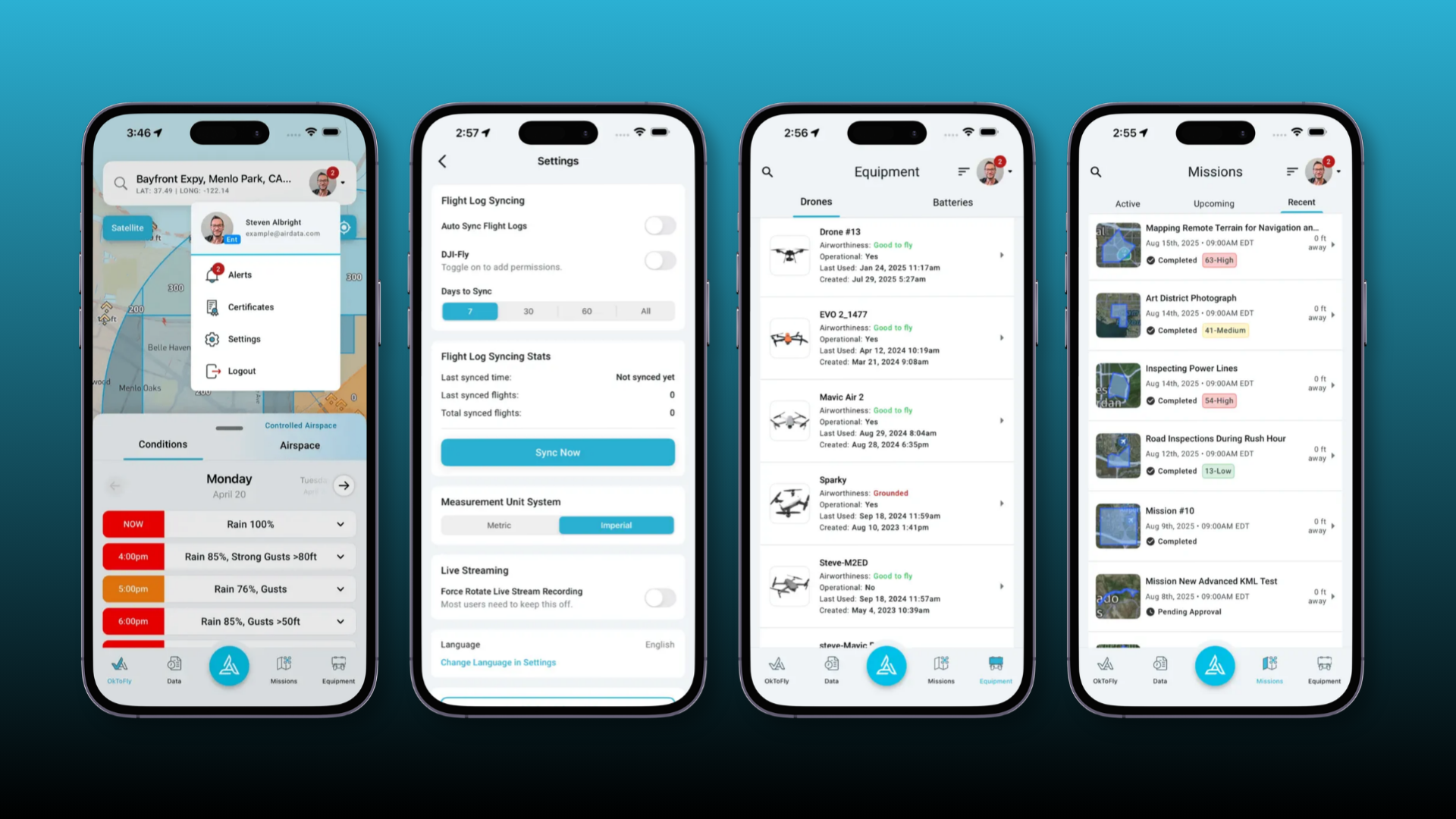
AirData's updated mobile UI includes a redesigned navigation bar, a new quick actions menu, improvements to Ok To Fly, a dedicated Equipment tab, better support for tablets and landscape use, an updated manual flight...

The U.S. commercial drone industry is at an inflection point. After years of incremental progress, the FAA's landmark Part 108 Beyond Visual Line of Sight (BVLOS) rule is expected to take effect later...

Menlo Park Fire Protection District (MPFPD), located on the San Francisco Peninsula in Northern California, has operated a UAS program since 2014. Over time, the program has evolved from manually deployed aircraft...

Public safety drone programs are scaling quickly, and with that growth comes a need for better visibility, documentation, and oversight. That is what makes AirData’s new integration with BRINC especially valuable for law enforcement...